|
At 15 miles to the inch... 106 meters per meter |
1 km |
10 km |
100 km |
1000 km |
||||||||||||||||||||
103 m
|
104 m
|
105 m
|
106 m
|
||||||||||||||||||||
|
top of troposphere ~12 km
height of 1/2 sea-level pressure
mean ocean depth |
|||||||||||||||||||||||
|
|||||||||||||||||||||||
Comments encouraged. - Mitchell N Charity <mcharity@lcs.mit.edu> |
Notes:
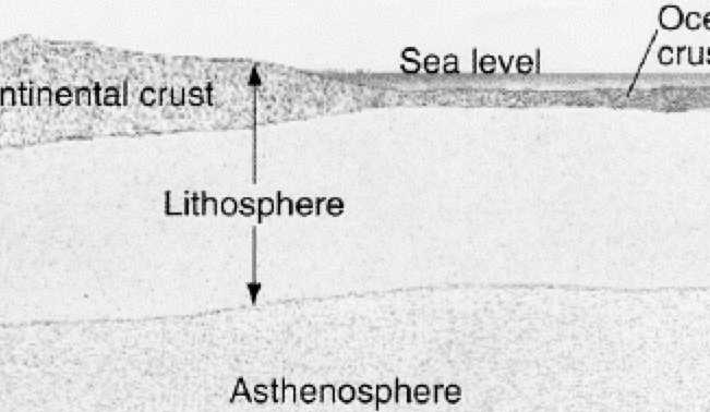
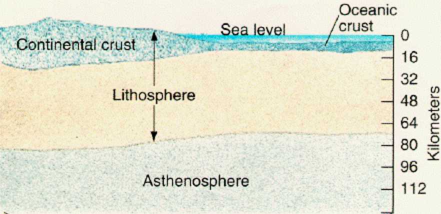
Earth cross-section mangled from THE INTERIORS OF THE TERRESTRIAL PLANETS.
Encountered using The Great Globe Gallery.
Clouds image from Picturing altitude above maps and NASA JSC Imagery Services.
Hmm... clouds image might be too small by a factor of two...? 15 km to tropo.
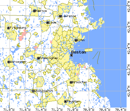
Boston map and scale bar is from U.S. Census Bureau's TIGER Map Service
and was generated Oct 97 using this URL.
USGS has some ok 1:1,000,000 maps (Boston is NK-19),
as does DMA/ONC (ids like F-19).
USGS has 1:100 000 metric maps (10 m contour lines), but while they are
a nice reference, I prefer the 1:25 000 series, because you can see local
streets and landmarks.
troposphere, depth, 1/2 pressure height - from [Cow p235]
Other meta info on zero magnification page.
Doables:
  Check scale of cloud image.
  On a sheet of paper
  Max ocean depth.
  How much does atmosphere depth vary?
History:
 2003-Feb-03   Repaired links - 1 fixed, 1 left (tiger).
 2002-Apr-11   Changed link (evacuating www.tiac.net).
 2001.Apr.20   Added link to `How Big Are Things?'.
 1999.Jul.17   Added sketch of earth cross-section.
 1998.Jun.17   Corrected error with magnitude boundaries (3.333->3.162).
 1998.May.09   Added ocean/atmosphere numbers.
 1997.Oct.17   Added boston map and scale bar.
 1997.Aug.25   Created.
