This is an (edited) excerpt from a late November 2001 email...
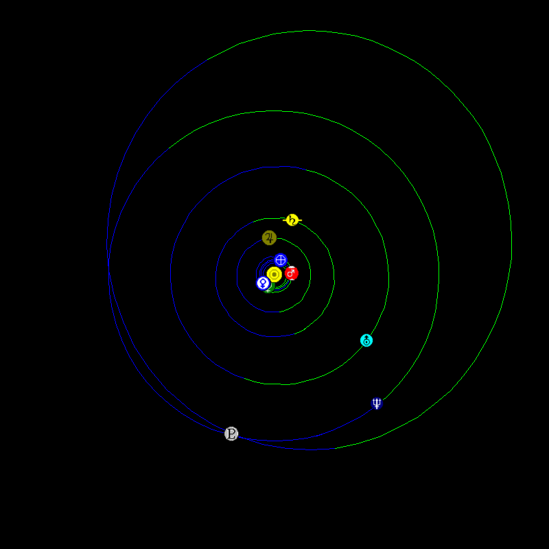
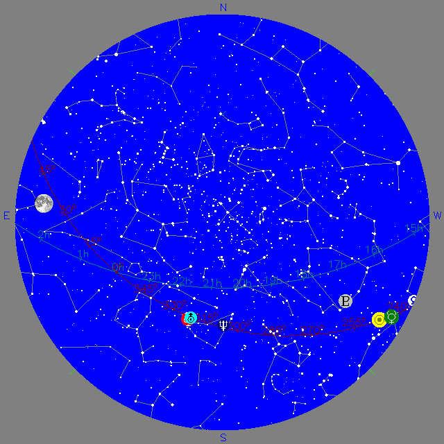
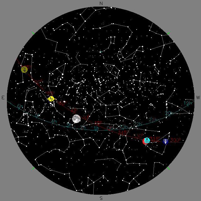
one additional thought comes to mind... Jupiter and Saturn (and Mars somewhat), are nice urban naked-eye targets this week. Neptune and Uranus are also up. http://www.skypub.com/sights/sights.shtml http://www.skypub.com/ http://www.mystarslive.com/ http://www.astro.psu.edu/users/stark/viewing/SkyMaps.html http://www.fourmilab.ch/yoursky/ etc, etc So... Schoolyard Solar System http://itss.raytheon.com/outreach/education/solar_system/school_ss.html is good at conveying that planets are tiny little dots in the context of the solar system, and that the solar system is flat with planets running around (counter-clockwise looking "down", southward, at them:). Solar System Live - Show Icons, Display FullSystem, Size 800, Orbits Real. http://www.fourmilab.ch/cgi-bin/uncgi/Solar?date=0&utc=1995%2F03%2F05+12%3A00%3A00 &jd=2449782.00000&img=-k0&sys=-Sf&imgsize=800&eyes=0&orb=-b1&lat=47%B0 &ns=North&lon=7%B0&ew=East&hlat=90%B0&hns=North&hlon=0%B0&elements= shows the current locations of the planets. So one can do the Schoolyard Solar System with real locations! Now, say that everyone/each-team visits Earth, looks around at the other planets, notices that they are all "in a line" (ie, the solar system is flat), Mercury and Venus are off behind the Sun, etc. The night sky is what is visible with one's back to the Sun. Holding a sheet of paper horizontally, they draw "rays" towards Mars, Jup, Sat, Nep, and Uranus (and back towards the Sun), from a point at the center of the left edge of the paper (say from the middle hole of a 3-hole binder paper). Notice the order, from right to left, is Neptune, Uranus and Mars, Saturn, and Jupiter. Now, in the evening... The setting Sun in the west (with Mercury and Venus hidden behind it), the rising Moon in the east, and Neptune, Uranus and Mars in between. It should be possible to "see" the plane of the solar system tilted up in the sky, an arc anchored by Sun and Moon, and pegged by planets in between. Especially if one knows approximately what angle above the horizon the ecliptic is. It looks like AR is about 35 N, so the solar system would be tilted up a bit more than half way to vertical.(?) One unfortunately has to wait a bit longer for Jupiter and Saturn to rise behind the moon. http://www.mystarslive.com/ Interactive Star Chart can help you figure out when. Holding the paper tilted up, the lines should point at the assorted planets (and Sun). !! :) I don't know how feasible it would be to take your students along this path. I don't even know what grade they are, how much time is available, etc. But if it were, after seeing and being a map of the current solar system, using star charts, and observing planets in the sky, they might have a good foundation feel for what the solar system is. On which one could then hang descriptions of the planets, etc. |
Thanks to a reader for prompting this page.
Notes:
  A quick and dirty hack of page.

Doables:
  Facilitate using SSLive w SchoolyardSS - postprocessor, generator, or _overlay_.
  Make more lesson plan-ish.

History:
  2001-Nov-28  Created.